About this location
Darling was located 5 miles south of Bala. It was named after the railway builder of the same name (1905). The last train stopped in 1965. The location died because there were no roads or water ways leading to it- making one wonder why there was a station here at all- for a station man to live at to fix the line maybe? (That makes no sense either as the station was so large. They wouldn't have needed something that large in order for a maintenance person to live at). Few maps today show the original point but I do have an old topo that does. In around the year 2000 all traces of this location were removed.
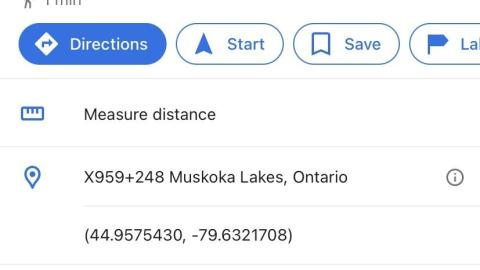
The pin on the map is the old Darling rail pt.. Darling is best viewed in satellite map.
Does anyone have photographs or more info?
This just in-- it was named after F. S. Darling, Divisional Engineer during construction 1907. There indeed was a house there in 1972 as a B Westhouse has informed me. He went past in a passenger train at that time. He says he also recalls a car being parked there, which is interesting due to no roads being present.
According to Cliff Beagan, who worked the CP line at that time in the 1950s, there was a water tower tank about half a mile south Severn Falls at Buckskin where the north switch existed. Just to the south of the river on east side of the track stood the Severn Falls train station used only in summer months. I wondered if Darling had one too. He claims that there wasn't during his time. Water was usually taken only at Bolton or Midhurst as a rule, but the one at Buckskin was there as a back-up just in case. In the 1950s the station at Darling was vacant and stood on the west side of the tracks. Immediately across the tracks stood the section shack. which housed the south switch for the siding here.
He recounts a story here. " There was a Conductor killed just south of Darling before my time. The story I was told that the southbound freight was stopped for some reason, and the tail end brakeman did not react soon enough to go flagging. A following freight did not have adequate time to stop and crushed the wooden Caboose. Sad part was that the Conductor reached the rear Platform of the Caboose when he heard the engine whistle, but was caught just a moment as he was about to leap clear. I can't recall what his name was."
Also. "Yes, there was a rock cut just south of the south switch at Darling. I think it held 56 cars. I think Stations like Darling and Roderick had a Section Foreman and his family stationed there in the early days, but with the advent of motor cars (which the employee had to personally purchase) the employees could live in Mactier, Bala, or Severn Falls area. Just a guess though."
Historic CPR mile listings: 103.2 Moredolphton station (closed),107.8 Buckskin station, 108.1 Severn Falls Station, 115 Darling Station, 119.6 Bala Station, 123.9 Roderick station
According to friend, Gary Long:
"Hi Clayton,
Depending how far you have to canoe up Nine Mile Lake (nine miles? Ha ha), it might be just as easy to hike all the way down from Bala--just a tad over 6 km to the former site of Darling from Bala; about 2.2 km down to Darling from the north end of Nine Mile Lake. I've marked Darling on the attached Google Earth snatch; this is the location shown on a topographic map old enough to still have it. Should be easy to find the spot. Past Nine Mile Lake, the railway makes one bend, then a straight stretch, and Darling was right where the railway starts the next bend (I don't know which side of the tracks). The location of Darling on the Google Earth map on the Ontario Abandoned Places website is not correct (or at least, is not where the topo map shows it).
If you walk another 1.5 km past Darling, you'll come to the Gibson River, with High Falls on the west side of the railway.
I never had a really old topo map showing Darling. The attached scan is from the 1:125,000 scale Orillia sheet from 1962 (the units on the dashed border at the top of map are 5 minutes, or 1.3 km at this latitude). The photograph shows the station on the outside of the curve, so it would be on the west side of the tracks. I can't figure out either why there would be a station of that size in the middle of nowhere. Nothing but bedrock ridges with swamp and marsh in between all around there. By the time the railway was built, the lumbermen had already come and gone. No farming. No tourism. No roads. Maybe the photo is actually some other station, although there's nothing in the background to suggest it couldn't be in western Muskoka. Unfortunately the station sign board isn't readable from the angle of the photo. There doesn't appear to be any other development around it. On Google Earth, I see that the land in behind the station location drops into a marsh.
Gary"
According to Mactier Sub Railfan member, Rob Srimgeour, " Here's all I can quickly find. It says there was a 56 car siding, and the sectionhouse was across the tracks from the station.
My guess is that it's location had to do with the distances from other section houses and stations, as well as the cheapest place to build a siding and buildings (between bridges?). Section housing was housing for the family of the section man. He walked his section of the tracks daily tightening bolts on joint bars, hammering spikes back in, and looking for defects."
Track walking section men and section houses are a thing of the past. They were replaced by section gangs with section foremen, with much larger areas to work."
According to Brian Westhouse, "In the early years when trains ran on train orders it was always at the next station or at a station up the line were a train was to take the siding, so trains that met at Bala would have been issued instructions prior to arriving at Bala.
The first time I saw Darling was about 1972 when I was riding The Canadian from Union Station to MacTier. There was a section house, but no indication of a station. I cannot remember if there was a sign or if I saw the name on an employee timetable. I thought someone was living there at the time, but from what I saw, was from a moving train and only a brief encounter. I remember seeing the existence of a building there south of Bala although I didn't know what its function was, I couldn't find any information on it then."
According to Reg Fitzpatrick, "Interesting that the building would have all the 'makings' of a normal train order station with no train order display appliances here. No 'Siding' for 'meets' unless it is out of the photo in either direction here.The 'wired' box atop the pole here shown would indicate 'Station' protection 'lightning' carbons and possible batteries for the older type land line use phones of the day ? The 'post' above the bay style station window shown may have been a train order lamp 'holder' used sparingly back then for Train Orders or Messages at that point. (?)"
According to Steve Woolfrey, "Once upon a time, similar boxes were the receiving points for carrier pigeons. Pigeons was my dad's foot in the door with CNR"
Albums 2
Comments
Comments
Please log in to leave a comment
How do I share a screen shot I took I managed to find proof that the station was their
Not sure if I’ll find anything but I’m heading there in the morning to check it out for a quick day trip! I’ll leave an update upon my return
5.jpg)
1.jpg)
2.jpg)
4.jpg)
3.jpg)


5.jpg)
1.jpg)
2.jpg)
4.jpg)

3 years ago
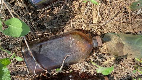
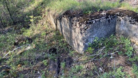
Ok , I hiked this one , Starting from Bala There's nothing really left of the station but the foundation. However there is a garbage dump at the back with all kinds of old bottles. You can definitely see where the Siding(Train term for maintenance track) was. The location on the map is functionally correct , it was just before Mile marker 110 ( Current marker system , not the historic one mentioned in the article )