OAP - Urbex Database
Social network for urban explorers
Alberta
Top cities in AB
British Columbia
Top cities in BC
Manitoba
Top cities in MB
New Brunswick
Top cities in NB
Newfoundland and Labrador
Top cities in NF
Northwest Territories
Top cities in NT
Nova Scotia
Top cities in NS
Nunavut
Top cities in NU
Ontario
Top cities in ON
Prince Edward Island
Top cities in PE
Quebec
Top cities in QC
Saskatchewan
Top cities in SK
Yukon
Top cities in YT
Alabama
Top cities in AL
Alaska
Top cities in AK
American Samoa
Top cities in AS
Arizona
Top cities in AZ
Arkansas
Top cities in AR
California
Top cities in CA
Colorado
Top cities in CO
Commonwealth of the Northern Mariana Islands
Top cities in MP
Connecticut
Top cities in CT
Delaware
Top cities in DE
District of Columbia
Top cities in DC
Florida
Top cities in FL
Georgia
Top cities in GA
Guam
Top cities in GU
Hawaii
Top cities in HI
Idaho
Top cities in ID
Illinois
Top cities in IL
Indiana
Top cities in IN
Iowa
Top cities in IA
Kansas
Top cities in KS
Kentucky
Top cities in KY
Louisiana
Top cities in LA
Maine
Top cities in ME
Maryland
Top cities in MD
Massachusetts
Top cities in MA
Michigan
Top cities in MI
Minnesota
Top cities in MN
Mississippi
Top cities in MS
Missouri
Top cities in MO
Montana
Top cities in MT
Nebraska
Top cities in NE
Nevada
Top cities in NV
New Hampshire
Top cities in NH
New Jersey
Top cities in NJ
New Mexico
Top cities in NM
New York
Top cities in NY
North Carolina
Top cities in NC
North Dakota
Top cities in ND
Ohio
Top cities in OH
Oklahoma
Top cities in OK
Oregon
Top cities in OR
Pennsylvania
Top cities in PA
Puerto Rico
Top cities in PR
Rhode Island
Top cities in RI
South Carolina
Top cities in SC
South Dakota
Top cities in SD
Tennessee
Top cities in TN
Texas
Top cities in TX
United States Virgin Islands
Top cities in VI
Utah
Top cities in UT
Vermont
Top cities in VT
Virginia
Top cities in VA
Washington
Top cities in WA
West Virginia
Top cities in WV
Wisconsin
Top cities in WI
Wyoming
Top cities in WY
Barn
Bridge/Locks
Cemetery
Church
Commercial
Correctional
Drain
Educational
Farm/Cottage
Foundations
Ghost Town
Hospital
House
Industrial
Mansion
Military
Mill/Foundry
Mine
Motel/Hotel
Other
Railway
Recreational
The Costume Shop
The Mascot Store
Dragon Ball Z Store
The Panties Store
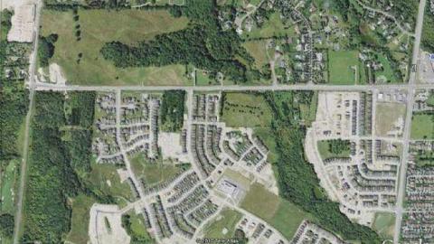
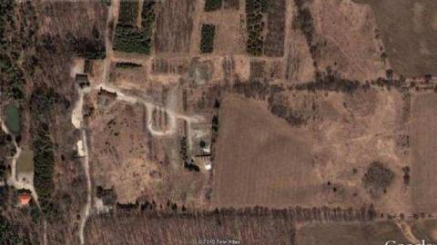
East Don Headwaters: Mnr Lands — Closed Educational in Vaughan, Ontario
Comments
Please log in to leave a comment
No comments yet
East Don Headwaters: MNR lands
Vaughan, Ontario