About this location
Markham Township was founded in 1793. To learn a bit about its early history read about William Berczy and German Mills also under the "Markham" heading.
Mongolia- In 1801 Peter de Guere aquired a crown deed to lot 26 conc. 9. These lands were in the hands of his son, James Deeger, by 1860. Andrew Clubine from New Jersey received land in the area in 1805, which was sold to Garret Lloyd, who in 1828 sold it to Jacob Barkey. John Farr got a deed in the area in 1806, and it passed through the hands of John Button, John Williams, the Degeers and then David Nighswander by 1832.
James Shannon was granted a tavern licence in 1841, and the area became known as California Corners. Then Nighswander requested a post office and chose Mongolia as its name in 1865 from a list of possible names.
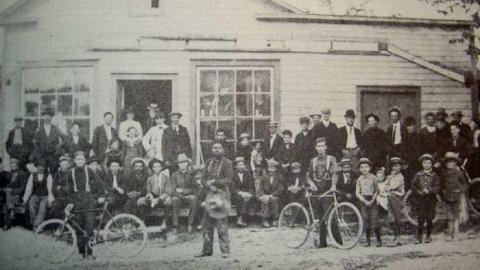
On the SE corner was a General Store run by the Crosby and then the Curtis family. Curtis became the 1st post master. The store burned down in 1920 when "Whistling Abe" Lehman was storekeeper. On the SW corner was the Degeers Tavern, which later became the location of another store. On the NE corner sat Calvert(a)s blacksmith shop, which may still stand. To the east was a Temperance Hall. The 1st school stood on the east side of 10th Line next to a Wesleyan Church and near a cemetery. A new school was built in 1882 on the west side of 10th Line. A woolen mill existed on Henry Barkey(a)s lot just north of the 4 corners.
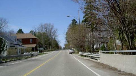
Improved roads ended Mongolia and the area reverted to farmland. It does, however, still appear on modern maps.
Cashel- 1st called Crosby(a)s Corners, then Fenwick Corners and finally Cashel in 1851 with opening of the post office. There was a sawmill, 2 stores, shoemaker, tailor, blacksmiths, wagonmaker, a tavern at the NW corner, and 2 Inns- the one Inn at the NE corner is still standing. The 1st Masonic Temple in Markham Twp existed just east of the Inn. There was also a broom maker and cabinet maker, with a population of 100 in 1866. Almost nothing remains today. There is now a Moslem mosque just north.
Almira- In 1851 no evidence of it existed- until 1866 when it was thriving on lot 30, conc. 5. Carding and fulling mills were run by John Bowman. James Bowman ran the store. In 1857 a post office was opened. There were weavers, a plasterer, a brickmaker, a photographer, a lumber dealer, blacksmiths, wagon makers, a veterinarian, a potter, a clock repairer.
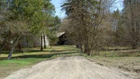
In 1880 Samuel Boyer Lehman bought the mills which operated until 1940 when they burned down. With the mills gone and the post office closed the thriving hamlet became forgotten. *This is the claim in Markham(a)s history book, however as evidenced in my photo below, a gorgeous mill still exists here.
Armadale- A hamlet at 8th Line (now Markham Rd.) and Steeles Avenue, it was named after a village in Scotland. Locals first took up land here in 1803. Names included: Mercer, Petch, Tinker, Walls, Stonehouse, Daniels, Delong, Dehart, Robb, Beare.
By 1850 a considerable hamlet had grown at the 4 corners. There were 2 stores, a blacksmiths, a brickmaker. In 1869 a post office was granted to Robert Harrington.
John Beare became the village(a)s main proprietor thereafter. He owned the store, post office and telephone switchboard. He also sold sewing machines and the 1st self-binding reaper in the area. In 1917 he sold the store when the post office was closed as rural mail service came to the village.
Just north of the store sat a temperance hotel. It was dismantled in 1939 for $25 and its wood was used to build farms. There was a school (SS#14), and a Free methodist Church (1880), which is now an historical site.
Today Hwy. 48 cuts through the area and speeders driving by have no idea of the activities of the past that happened here, as all evidence has disappeared.
- There are other 19th century hamlets and villages that dotted the Markham landscape and yet remain on modern maps. Some are still vibrant with new housing developments, while others have faded from memory. In all, these others include: Langstaff, Dollar, Headford, Victoria Square, Buttonville, Brown(a)s Corner, Hagerman(a)s Corner, Milliken, Cashel, Milnesville, Box Grove, Cedar Grove, Elgin Mills and Locust Hill/Belford.
For the 1877 Map of Markham Township: http://digital.library.mcgill.ca/CountyAtlas/SearchMapframes.php
For the 1948 map pf the area go here: http://maps.library.utoronto.ca/datapub/digital/3400s_50_1948-[30M14W]3rd.jpg


