About this location
Ishpatina Ridge is the highest point of land in Ontario, at an estimated 693 m (2,274 ft) above sea level. It rises approximately 300 m (984 ft) above the immediate area.
The ridge lies in Lady Evelyn-Smoothwater Provincial Park. It is a very remote location as the nearest highway, Highway 560, is more than 30 km away, and roads and trails in the remote area are difficult to travel in poor weather. The most popular approach routes to Ishpatina are by canoe and/or float plane, although some brave souls have walked to the ridge from the nearest road.
The name "Ishpatina" comes from an Ojibwe language word ishpadinaa, meaning "be a high hill/ridge". Spadina Avenue in Toronto is derived from the same word.
Although the Ishpatina Ridge is considered the highest point in Ontario, at least one other geographic feature, Maple Mountain has a greater vertical rise (also written about on this site), 37 m (121 ft) higher than Ishpatina Ridge's rise over Scarecrow Lake.
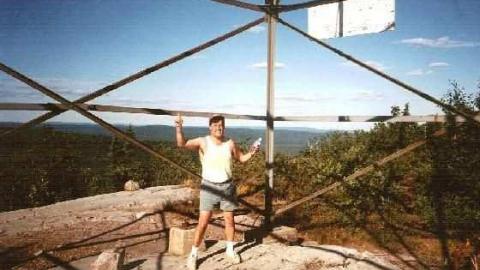
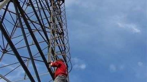
An abandoned firetower, often referred to as the Ellis Tower (Ellis is the surveyed township name), is still standing on the highest section of the Ridge. Photos are included below.
CN Tower connection:
Toronto's CN Tower's top is almost the same height above sea level as the top of Ishpatina Ridge. It is 553.33 m-high (1,815.4 ft). Toronto is about 250 feet above seal level, making the top of the CN Tower about 2065 feet above seal level. So if you were to fly a plane from above the top of the CN Tower and remain at the same height as you headed toward Ishpatina in Northern Ontario you would crash right into either the mountain or the fire tower itself...Anyone want to give this a whirl to test my theory? hehe
Albums 1
Comments
Comments
Please log in to leave a comment
Hi quicksilver..nope I haven't made it there yet...maybe one day so u can beat me to it and add your own photos in due course :) Got permission to post Simply Red's photos on here--aka Dean Martin
my heart broke when I read the title, I knew exactly what and where it was. This is on my to do list and I thought someone beat me to it, judging by your pics/credits you didn't make the trip up?
Well then I would have a person in the fire tower guide you in via two-way radio for a crash landing..If at 1st you don't succeed-try, try again..I still think it could work..
Yea but what if it was a Thursday, you didn't reset your altimeter, there was a high pressure system over the location & the air temperature was 28C at altitude?
The bottom 20 ft of the ladder have been cut off so that no one can climb to the top, but folks manage to do just that anyways...


4 years ago
I just went here this weekend. Tower still stands, ladder is in the same condition as in the photos. No more cabin at the bottom, or at Dick Lake (unless it's very hidden). There is a cabin on the south shore of the lake, though!